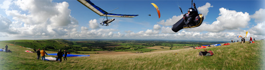
Free Flying on The South Downs
Flight
| Flight details | |||||||||||||
|---|---|---|---|---|---|---|---|---|---|---|---|---|---|
| Title: | Dyke to Kingston | ||||||||||||
| Site: | Devils Dyke | ||||||||||||
| Pilot: | John Porter | ||||||||||||
| Date of flight: | 25th June 2013 | ||||||||||||
| Wing type: | Paraglider | ||||||||||||
| Flight details: | I found it a bit difficult to get up and stay up for the first hour and a half but after that managed to stay higher for most of the time, with a (what seemed like a) lowish save (but probably wasn't so low) along the way near the A23. Never managed to get to cloudbase. Drifted towards Kingston. Thumbed a lift back to the Dyke. |
| Cross-country league entry | |||||||||||||||||||||||
|---|---|---|---|---|---|---|---|---|---|---|---|---|---|---|---|---|---|---|---|---|---|---|---|
| Flight type: | Flight with 3 turnpoints | ||||||||||||||||||||||
| Takeoff: | 50.891,-0.2102 | ||||||||||||||||||||||
| To: | 50.887383,-0.244667 | ||||||||||||||||||||||
| To: | 50.8923,-0.185633 | ||||||||||||||||||||||
| To: | 50.908833,-0.1943 | ||||||||||||||||||||||
| Finish at: | 50.861583,-0.001467 | ||||||||||||||||||||||
| Landing place: | Field east of Kingston, near Lewes | ||||||||||||||||||||||
| Witness: | GPS | ||||||||||||||||||||||
| Distance | 23.14 km | ||||||||||||||||||||||
| Score | 23.14 km | ||||||||||||||||||||||
| GPS evidence from: | XC.011820.igc |
| Comments |
|---|