| Flight details: | (copied from my FB post so don't feel you have to read it twice...!)
Bank holiday Monday rolls round again and for the second time in a row it was flyable. This time the intrepid trio of John, Greg and myself headed out to the Milk Massif with what we thought were ambitiously epic plans of 50k, 100miles, and anything over 8k respectively (that was my last XC from MHWH). It wasn't until we gave hangie Neville Almond a lift up the hill that we understood the real meaning of epic after a conversation along the lines of:
Us: Where's your declared goal?
Nev: York
Us: No, really, where is your goal?
Nev: York - 190 miles....
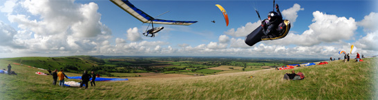
We set-up on the bowl and got an hour or so of boating around in with never more than 6-8 other wings. A bit of lift, Greg flying all over the place, John and I pushing out in front, but no really outstanding climbs and then the warm front arrived and everything shut down for a bit.
Wind then swung round to the south and whilst Greg heroically managed to fly round the front with just a small bit of kiting to finish off John and I opted to hike over. By the time we arrived it looked like we were last to the party as there were at least 25 wings in the air and the same again on the ground. Lots of vertical separation and once in the air you found there were plenty of different lifty lines between the launch area and the white horse.
With plenty of nuggets from Greg's thermal talk in mind I kept trying to feel one side or the other lift, then weight shift into the lift followed by a turn. Still some practice to get it tight but it was definitely working. After 30-40 mins of climbing up to 1300ft or so, falling out of it, regaining the lift, eventually I found myself sitting 500ft over the horse on half bar and drifting backwards at 5-6 km/h. Maybe it was getting a bit strong? So decided to push forward and start thinking of coming in to land when I picked up a steady 1-2 up and decided to see where it took me. 3 others had a similar idea |