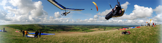
| Flight details: | Got to Milk Hill at 11 am on a flyable Bank Holiday and was only the second person there! Wind refused to go SW as forecast, so walked around to the South facing part (White Horse).
Luckily there was a lull in the wind as I set-up, then launched into the thermal up to 3000', pushed forwards to a nice looking Cu and drifted back in the climb to 5000'. Had to push east to avoid Lyneham airspace and joined the bottom of climb with another paraglider higher up. Drifted north in a couple of climbs and scraped around the eastern part of the airspace.
East of Swindon there were loads of sailplanes marking lift which made things easier - although a gaggle of steeply banked sailplanes does look like the perfect paraglider blender! Panic ensued when my GPS beeped at me to tell me I was in airspace! Turned out it was confused by an AIAA. Joined up with a couple of paragliders as we we got pinned on the southern edge of Brize Norton airspace and made slow progress eastwards towards Oxford. Eventually couldn't find a strong enough climb to make progress across wind, so landed west of Abingdon.
Caught a bus to Oxford, train via Reading to Pewsey where I didn't fancy waiting an hour for a cab, so I walked what turned out to be 6.5 miles back to the car! (It doesn't look that far on an airchart!)
Most of my flights are now in Thames Valley, so don't think I should really keep entering them in the Southern flight diaries. Will enter flights in more exotic locations though, like darkest Wales.
|